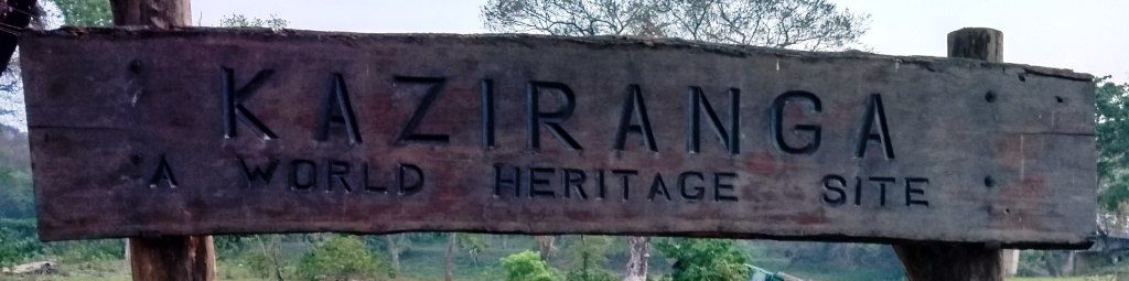
The State of Assam is the central state in the North-East Region of India and serves as the gateway to North East India and is a jewel in the crown of the Seven Sister States. The land of red river, blue hills & lush green tea gardens, Assam comprises of three main geographical areas: the Brahmaputra Valley, the Barak Valley and the intervening Karbi Plateau and North Cachar Hills. Famous for its freshening world class tea, the Muga (Golden) and Eri (Ahimsa) silk, Natural resources like Coal, Petroleum products and minerals, Assam can truly be described as a state bestowed with breathtaking natural beauty, vast reserves of natural resources and a rich bio diversity.
But for some reasons this State had been ignored by the Republic of India as has been the other States of North East India since India’s Independence. Lack of Industries, jobs for the youth, no proper infrastructure and many other reasons have not allowed this State to be able to compete with the other developed States of India. But with recent movements of neighboring countries along the International borders near the State of Arunachal Pradesh has changed the attitude of the Government in India and major initiatives have been taken up to improve the Infrastructure of the State to facilitate the movement of people along the States of North East India and the troops of the Indian Military along the International Borders.
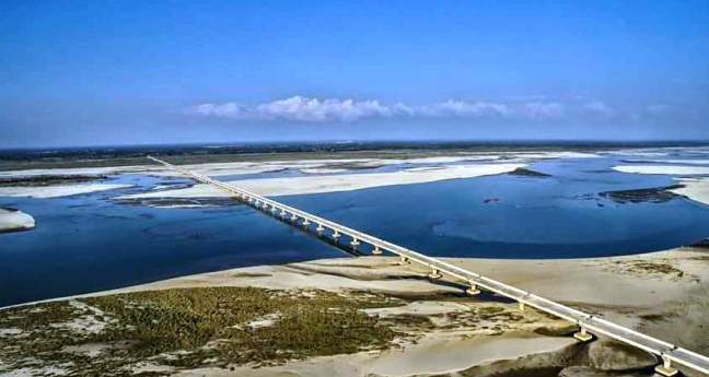
One example of this initiative to improve the Infrastructure in North East India is the ‘Dr. Bhupen Hazarika Bridge’ aka ‘Dhola-Sadiya’ Bridge on the River Brahmaputra. About an hours drive by road from the commercial capital of Assam at Tinsukia will lead you to a small town of Dholla in the extreme North Eastern part of India. This is where a bridge of Strategic National Security Interest – the ‘Dr. Bhupen Hazarika Bridge’ aka the ‘Dhola-Sadiya’ bridge is located. Scheduled to be operational on May 26th 2017 (to be inaugurated by the Hon. Prime Minister of India Mr. Narendra Modi) this bridge will connect the State of Assam and Arunachal Pradesh cutting down the travel time across these States by four (4) hours. Standing tall and long at 9.15 kilometers (5.69 miles) in length this bridge will also help the people of Assam and Arunchal Pradesh to move freely across the mighty River Brahmaputra thereby leading to a gradual improvement of a much needed trade route. The Sadiya Ghat (Sadiya Port) as the locals call it, at present serves as the only means of communication across these States where Steamers ferry passengers and transport across the River Brahmaputra. The Brahmaputra known for its peril of causing immense destruction across the State of Assam by flooding its waters during monsoon brings this transport means to a complete halt thereby depriving people of getting access to their basic amnesties during the rainy season. This bridge will prove as a savior to all and bring back the State of Assam as well as the other States of North East India on the Indian map as a place of prime National Interest!
Jungleideas welcomes you to India’s North East to witness the Grandeur of the Longest Bridge in India – the ‘Dr. Bhupen Hazarika Bridge’ aka the ‘Dhola-Sadiya Bridge ‘ on the River Brahmaputra, Sadiya Ghat, the State of Assam, Incredible India!
PS: IMAGES SUBJECTED TO COPYRIGHT. PLEASE REFRAIN FROM COPYING. FOR USE KINDLY PROVIDE IMAGE CREDITS.


BRO directions to Tezu and Parashuram Kund in Arunachal Pradesh


Bogibeel Bridge Dibrugarh. Credits: Vikramjit Kakati

The Bridge of Dr. Bhupen Hazarika aka the ‘Dhola-Sadiya’ on the Mighty Brahmaputra


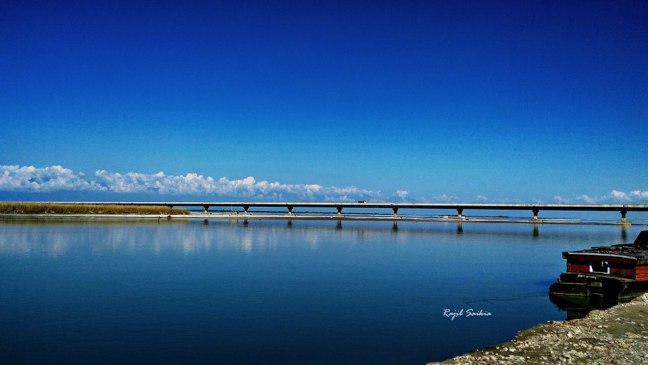
Beautiful View of the Dr. Bhupen Hazarika Bridge aka the Dhola-Sadiya Bridge on the River Brahmaputra. Image Credits: Rajib Saikia


